
Home
Appendix
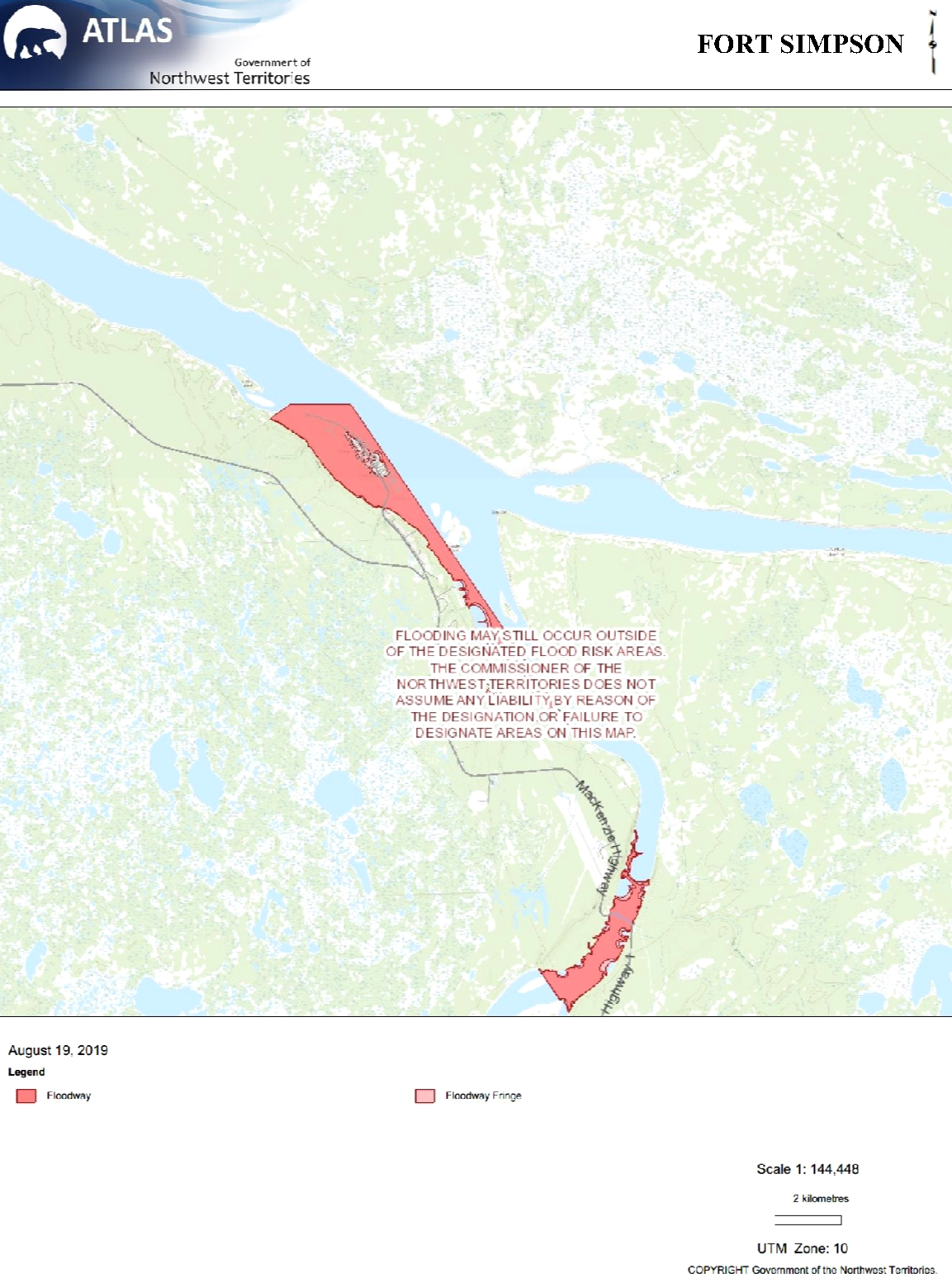
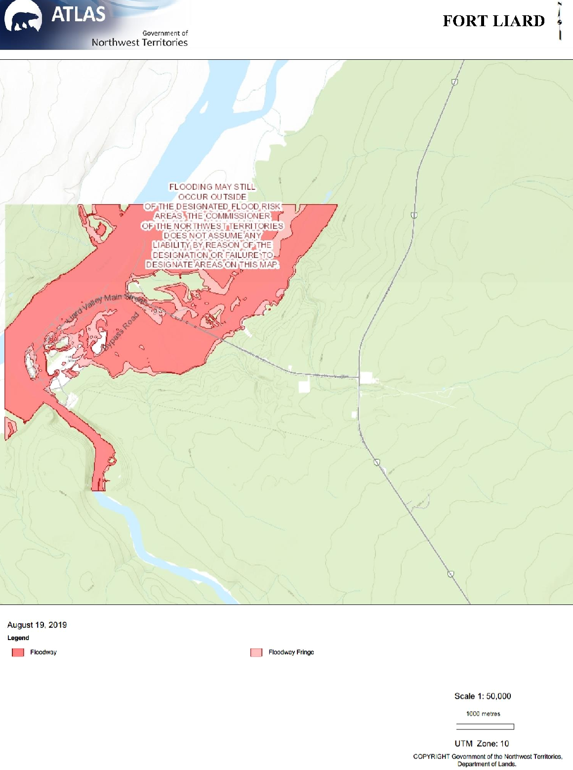
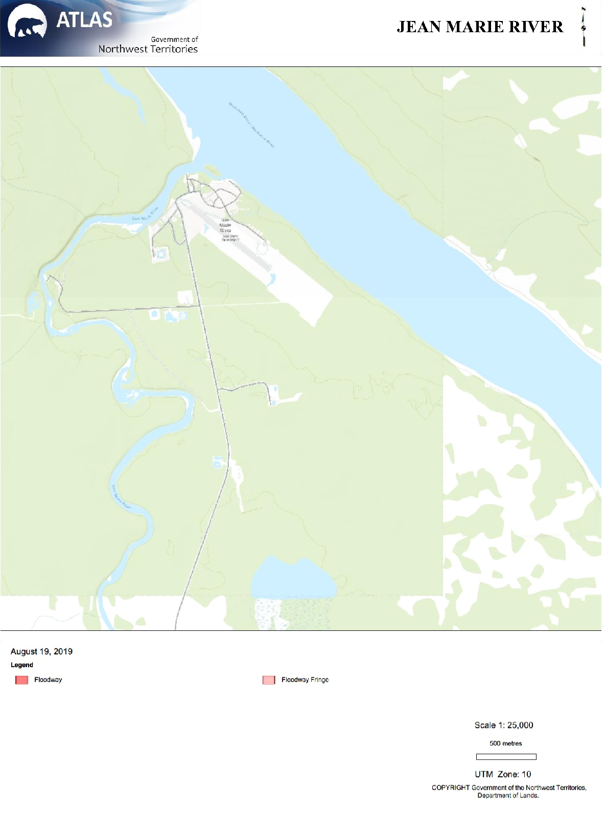
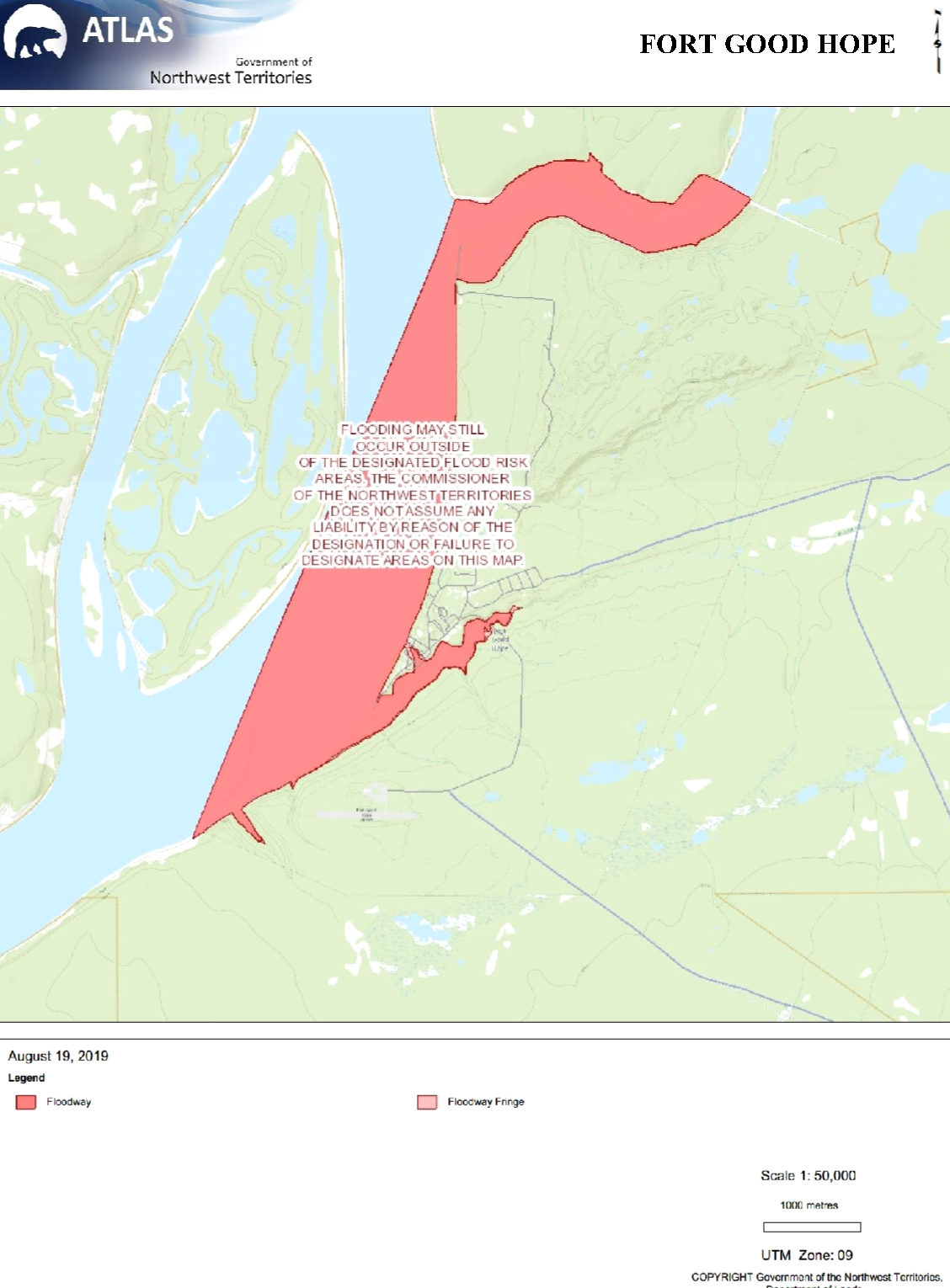
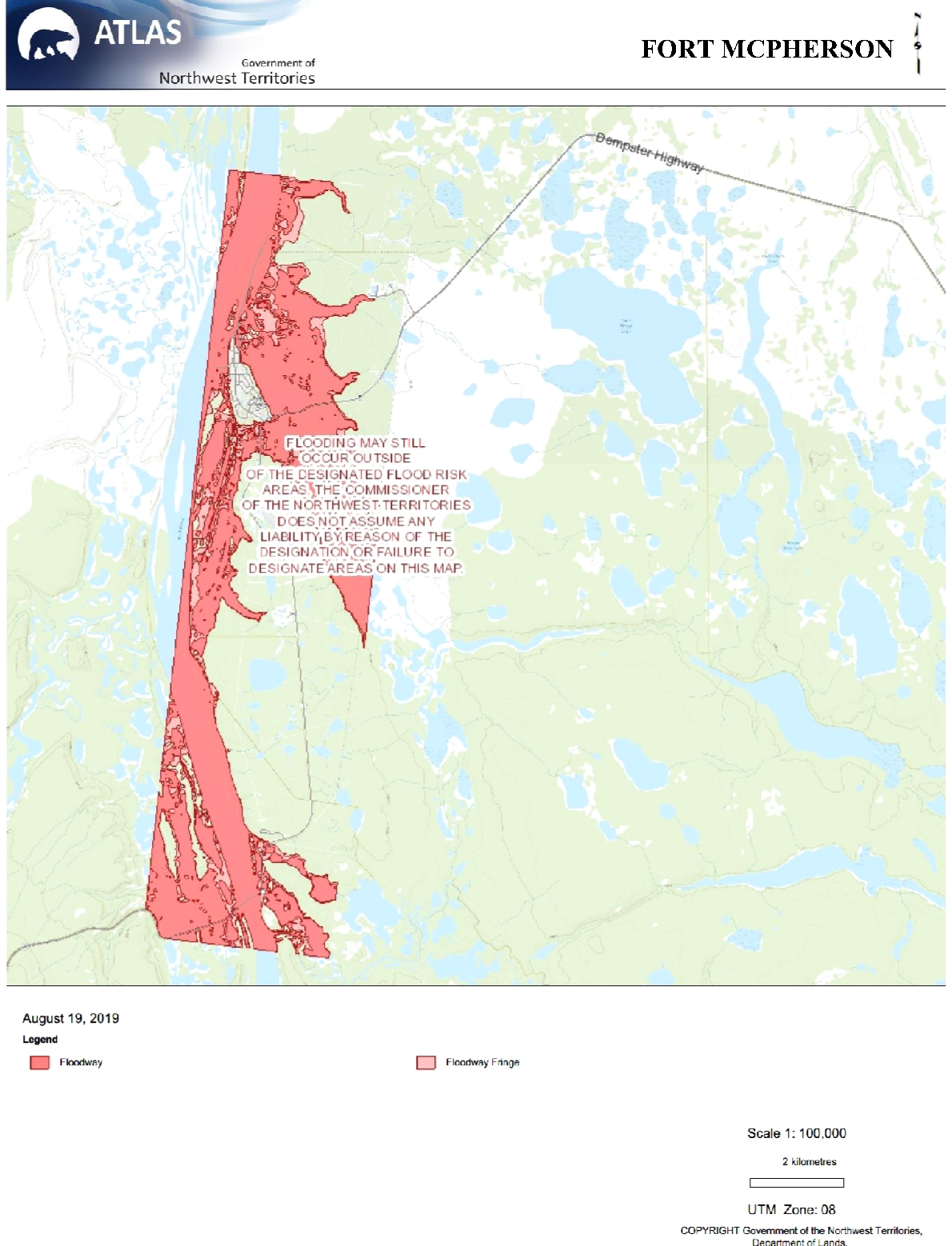
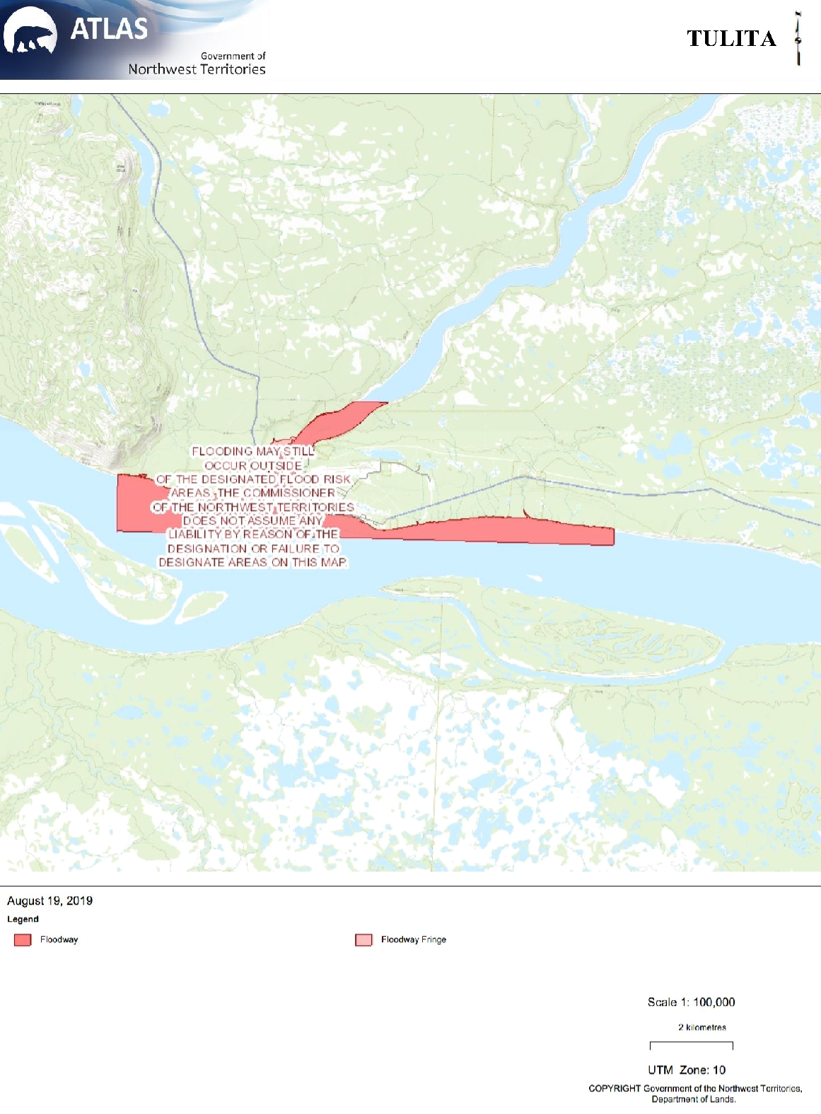
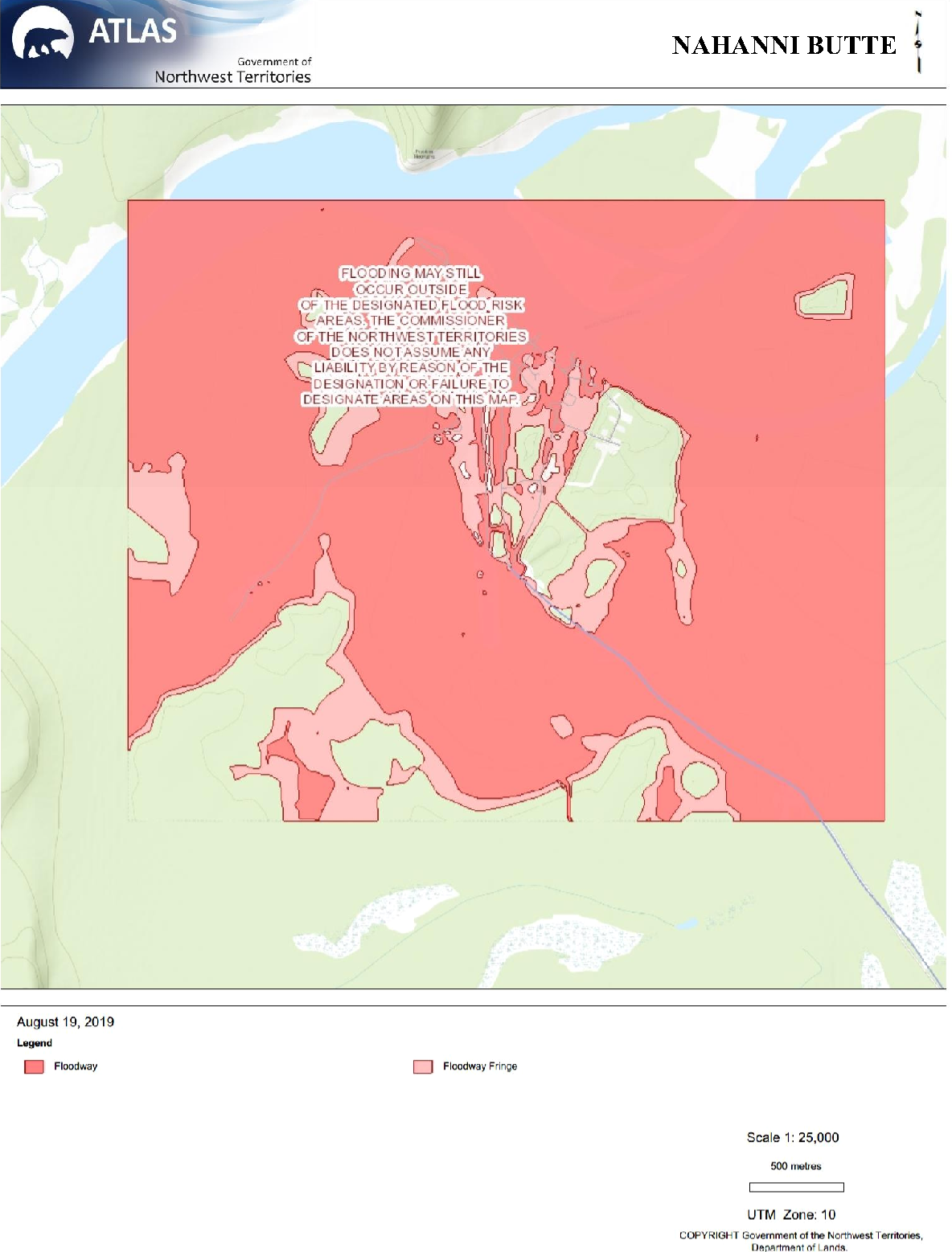
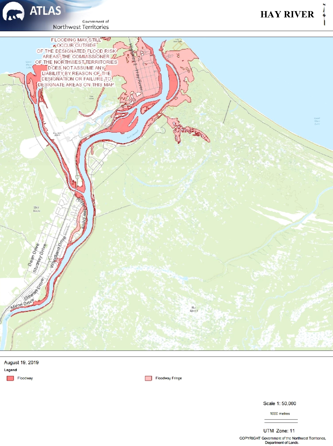
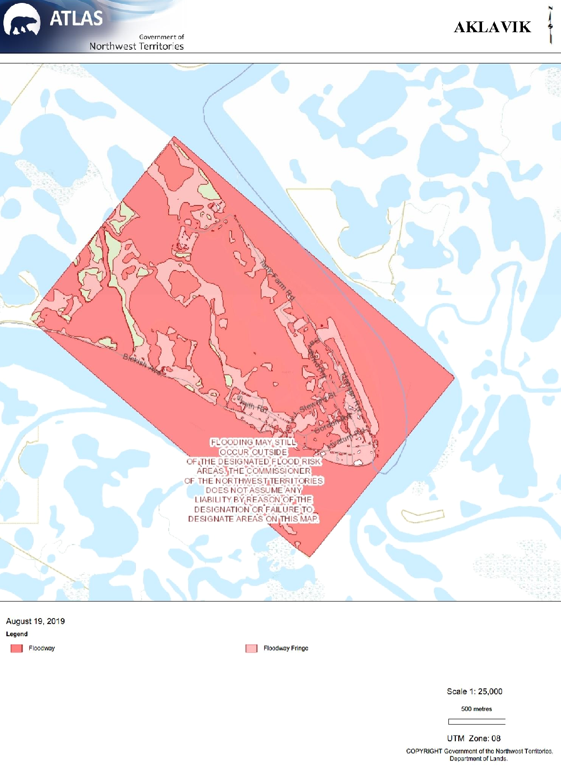
APPENDIX C: FLOODPLAIN MAPS
 { width=100% }
 { width=100% }
 { width=100% }
 { width=100% }
 { width=100% }
 { width=100% }
 { width=100% }
 { width=100% }
 { width=100% }
The floodway shows all elevations below that designated under the Canada - Northwest Territories Agreement Respecting Flood Damage Reduction and Flood Risk Mapping in the mid-1980s. The floodway fringe is a flood risk area and shows all areas where the elevation is 1.0 meter or less higher than the flood water elevation.
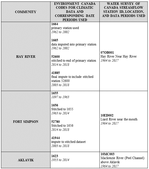
APPENDIX D: METEOROLOGICAL AND HYDROMETRIC STATIONS FROM ENVIRONMENT CANADA AND THE WATER SURVEY OF CANADA
 { width=100% }
APPENDIX E: R CODE
Below are the scripts from R that were used in the data analysis portion of this report.